Emei Shan is one of the four sacred mountains of Buddhism in China and offers an unforgettable hiking adventure in Sichuan Province. Renowned for its winter snow and stunning above-the-cloud views from the 3,099-meter peak, Emei Shan is a must for any hiking guide to China. If you’re planning to hike Emei Shan and want to minimize cable car and bus use, this article provides all the travel tips and details you need, along with photos to inspire your journey.
Like many mountains in China, Emei Shan is highly accessible for travelers who prefer not to complete the full hiking adventure. Buses transport visitors to Leidongping, just 7 kilometers from the sacred mountain’s peak, and a cable car can take you the rest of the way. If you’re short on time or want to skip hiking, these options are available—just keep in mind that convenience comes at a higher price.
As someone who loves hiking and adventure, I usually prefer challenge over convenience. For our Emei Shan hike, my friend and I had just two days, so we did a compromise – we hiked the 52 kilometers up the sacred mountain and used transportation to descend. This approach gave us the full hiking experience one-way and fit our travel schedule—read on for travel tips and photos from our journey in this hiking guide to Emei Shan, China.

A slightly visible sunrise near the top of Emeishan

Very steep stairs, seen frequently while hiking Emeishan
How Many Days Do You Need?
My friend and I spent 2 days, 1 night hiking Emeishan. Most travel guides and blogs I encountered recommend taking the bus to Leidongping and only hiking the final 7 kilometers, but we wanted a true hiking adventure. Feeling somewhat disheartened and worried that we couldn’t hike all the way up, we decided to try anyway. Although the trek is challenging—expect endless steps instead of dirt paths, especially near Buddhist temples—we managed to hike 45 kilometers in one day, resting in Leidongping before making the final ascent at sunrise. We needed the second day to descend and also catch a train back to Chengdu (1 hour) and then Chongqing (a little under 2 hours from Chengdu). We decided to hike up and then take transportation down: challenging, but doable with the time we had.
If you use transportation both ways, Emei Shan can be a day trip, but I recommend taking time to truly enjoy the sacred mountain. Embrace the adventure—if you have three days, consider hiking both up and down for the full experience.
Getting to Emeishan from Chengdu
The high-speed rail takes about one hour from Chengdu East (Chengdu dong) to Emeishan, with frequent departures. We chose the earliest departure, 6:12 a.m. Upon arrival at the Emeishan train station, you can buy your entrance ticket and take a bus directly to the starting point; most travelers go all the way to Leidongping (7 kilometers from the top and about a 2-hour busride), but you can opt for the bus to Wuxiangang for the full hiking route.
We waited a few minutes for the bus to Wuxiangang, and then were on our way. The bus took around a half hour. All in all, we started hiking at about 8:00 a.m.
Pro Tip: Don’t miss out on Chongqing during your trip, which is only a few hours from Chengdu and was my home base in China for a year. Check out all the spicy things to do in Chongqing, or consider a trip to the Dazu Rock Carvings.


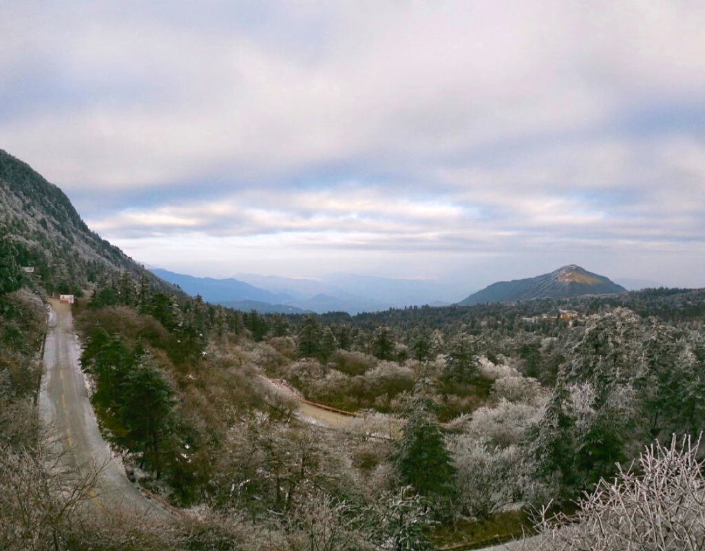
Very different views hiking up Emeishan before it got snowy
Cost of Doing the Emei Shan Hike
The entrance fee is the only required cost listed; other costs depend on your chosen hiking and transportation options. All prices and options remain accurate as of 2025.
No need to buy round-trip bus tickets from the train station if you’re unsure if you’ll use it; you can purchase a bus ticket in Leidongping when descending, as we did. If you want an earlier start on your Emei Shan hiking adventure, consider staying overnight in the nearby town of Emeishan at the mountain’s base.


What to Pack for a Winter Hike Up Emeishan
• Essential winter gear: hat, gloves, scarf, winter jacket, wool socks, and hiking boots
• Extra layers for changing if you sweat—staying dry is important, especially in cold, windy areas like the Golden Summit
• Wool socks and hiking boots provide warmth and grip on slippery steps
• Cheap crampons are available from vendors along the hike (around 10 yuan), and a bamboo stick (about 3 yuan) offers extra support
• Bring lunch and snacks; food options become limited as you ascend, until you reach the town of Leidongping
Where to Stay Overnight
Options are pretty frequent when it comes to lodging while hiking Emei shan, but mostly you can choose from monasteries or boutique hotels.
• Monasteries: basic accommodations, usually 30–50 yuan per bed; affordable but not heated, so bring extra layers
• Hotels in Leidongping: many options are typically available, with a 2-bed room for around 150 yuan per night
• Some monasteries are located just a few kilometers from the peak, perfect for those wanting to stay close to the summit
Hiking Emei Shan: Measuring the Distance

Starting your hiking adventure from Wuxiangang, there are two main paths to the top of Emei Shan. The most popular route, which is a bit less strenuous, involves turning left at the Qingyin Pavilion and heading toward the Monkey Area. The hiking paths are well-marked at the beginning, making it easy to follow signs, but as you ascend, signage becomes less frequent—so if you rely on checkpoints and distances, be sure to screenshot the below part of this hiking guide section for reference.
Who Can Do the Emei Shan Hike?


Not so steep stairs, but getting slippery
If you plan to hike from Wuxiangang, you should have moderate fitness and good endurance—our hike took about 10 hours the first day to reach Leidongping, and another 2 hours the next morning to reach the summit. We then took the cable car and bus down, but you could also take transportation up and hike down. If you want to hike Emei Shan both ways, allow for three days, as descending can be slow due to ice patches; two days is possible if you stay overnight in the nearby town.
However, as mentioned above there are other options if you’re not confident about hiking the entire way. Keep in mind that once you start the Emei Shan hike from Wuxiangang, you must reach Leidongping before you can take the cable car—the hiking path does not intersect with the bus road, so you can’t switch to a bus mid-hike. Plan your adventure on China’s sacred mountain accordingly.
What I’d Do Differently
I truly enjoyed my Emei Shan hiking adventure and wouldn’t change much, but I found that hiking early for the sunrise at the summit on the second day wasn’t worth it, especially in mid-December when it’s colder and visibility is low. If you want to catch the sunrise, consider going later in the season for better weather and clearer views.
I also wish I had packed more layers—sweating during the hike left me cold and wet at the Golden Summit, which can be risky in low temperatures. Follow these travel tips: bring extra warm layers you can easily add or remove for a more comfortable hike on China’s sacred mountain.

A large statue at the top of Emeishan

The sunrise at Emeishan
Additional Travel Options Nearby
Do you have more time after hiking Emei Shan and want to do more hiking and/or exploring? Check out my other posts:
- For a day hike near Chengdu, try hiking Qingcheng Back Mountain—it’s a great trekking adventure that’s less crowded and can be completed in one day.
- If you’re going to Chongqing next, check out all the spicy things to do in Chongqing, or consider a trip to the Dazu Rock Carvings.
- Wulong, located in nearby Chongqing Province, also has some nice, albeit much less intense, hiking options within the Wulong Karst National Geology Park. It is easily connected to Chongqing city by train and became famous after one of the Transformer movies was filmed there.
- Going even further and a hiking fiend? Check out my posts on hiking in Shenzhen and hiking in Guilin. Another option near Guilin is the Xingping to Shawan day trek.
Liked this post? Pin it!


Subscribe to receive Snook Outta Water’s monthly newsletter with exclusive updates and content.
Leave a Reply